GE2018/SSA2215 Lab 1
Today is the first lab for my SS module SSA2215, Biophysical Environment of Singapore. Guess what we did for the lab.... We took a little walk around NUS. Yes... NUS. Objective of the walk is to look out for some terrestrial problems arising from the modification of the natural environment into urban environment. Here's a brief walkthrough of the landscape we observed.
1. This is just an ordinary photo of a footpath just outside LT 11 which may not seems to tell much about how urban landscape affect the natural environment. But the very fact that the footpath is there is due to people constantly walking along the same stretch, exerting pressure on the soil beneath and making it so compact that even cowgrass cant grow on it. Eventually, the stretch is being laid with concrete. An example of soil disturbance caused by constant trampling. 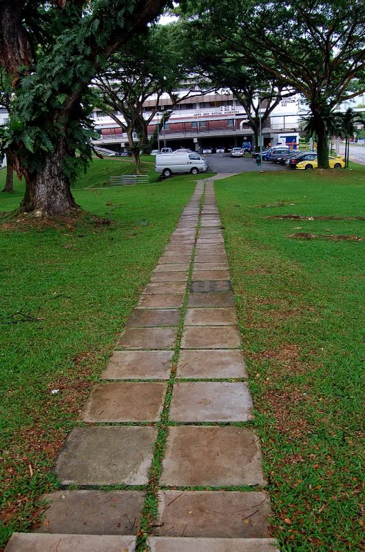
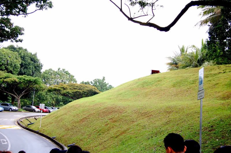
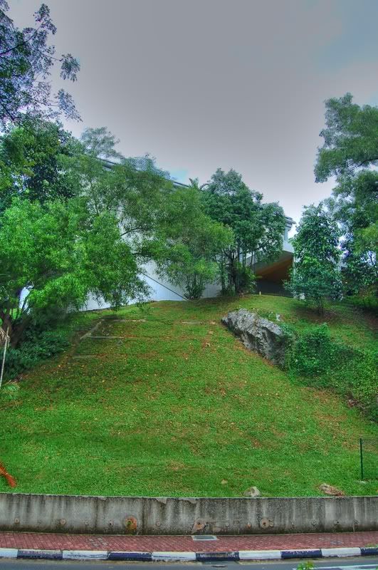
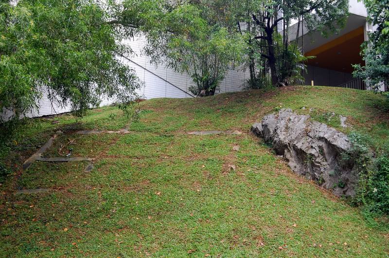
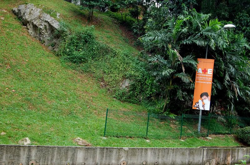
2. Slope Modification. This is a slope near the School of Design and Environment where it is being urbanised and had man made structures built on top of it. This results in large amount surface runoffs during heavy rain and when the soil is unable to hold the sudden influx of water, landslides can occur. It is said that a landslide occured at this location 3 years ago. Ironic isn't it... at the School of Design & Environment.
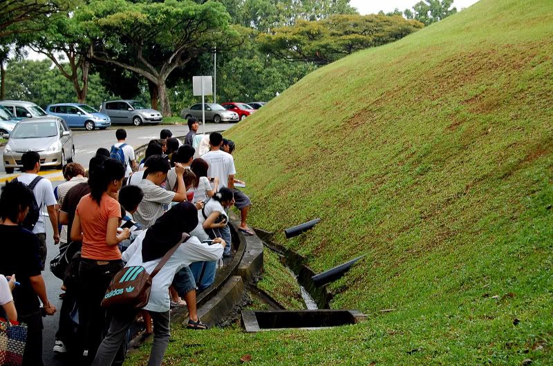
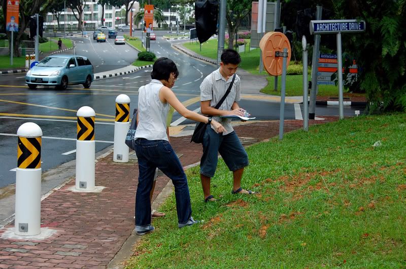
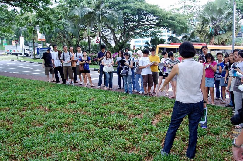
3. Just a candid picture of everyone chionging to go take the pipes at the drain. Just like what Neil Humphrey said, we all just rush to some place, snap, and go. Come on, the drain isnt gonna run away.
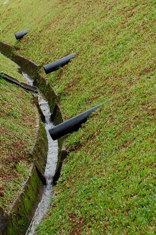
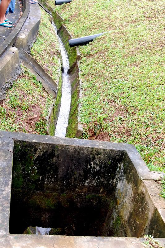
4. Ok.... to the drains.... These drainage pipes are installed to run beneath the slope so that they can drain excess water away from the soil during heavy rainfall. However, we didnt see any water draining out from these pipes although the drain is running with water after the rain that just stopped.
5. I once remembered someone (Probably another Geography lecturer) telling me what are these structures for. Apparently, they are built to hold excess water in an event of sudden surge of water coming in, so that the drains wont overflow. Too bad I didnt take to show how it is like top down.
6. Just another candid pic. Not sure what the lecturer is explaining though.
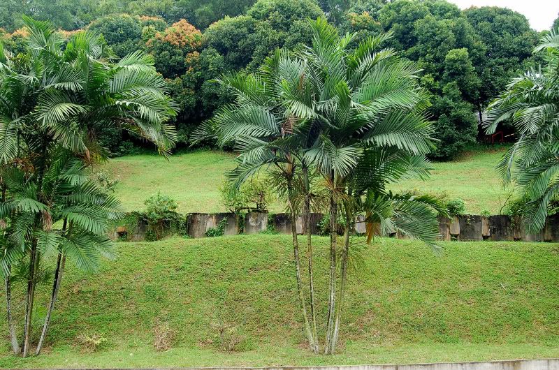
7. The third site we visit, showing how we can modify a slope to stabalize it. Again this place is prone to landslide. Improvement to the slope includes drainage holes, concrete slabs to stabalize the ground and a fence built to prevent the rocks from falling down in an event of a landslide.
8. Showing the concrete slabs (half covered with grass) implemented to stabalize and hold the soil on the slope together.
9. The fence to prevent the huge chunk of rock from rolling down to the footpath below.
10. Not sure what are they for, perhards to prevent landslide also.
11. Lastly, this place is just before the round-a-bout at YIH showing urban vegetation and the soil and how it impacts the grass growing on it. The grass here seems to grow on "spots" and its like they are just newly planted. But no on closer observation, its just because the bare spots are quite unsuitable for plant growth.
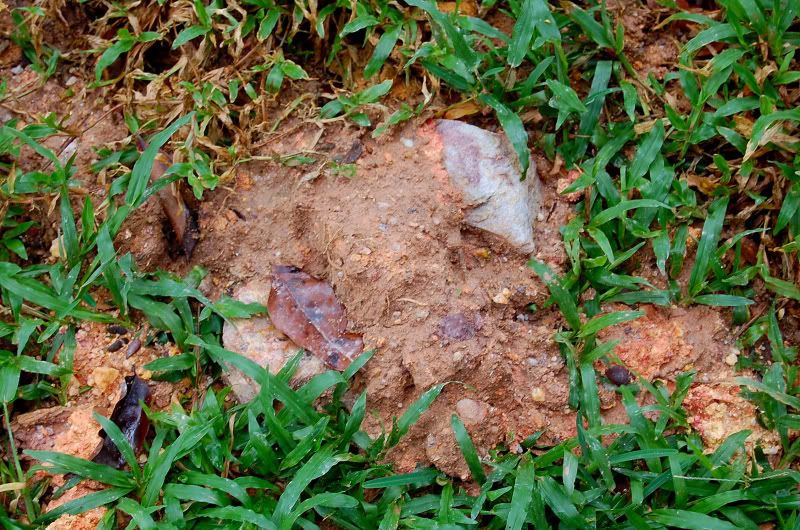
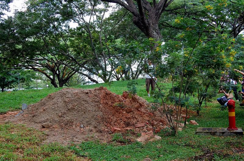
12. Close up of a bare spot with clay, rocks and sand.
13. Pile of unused soil left here after a recent construction.
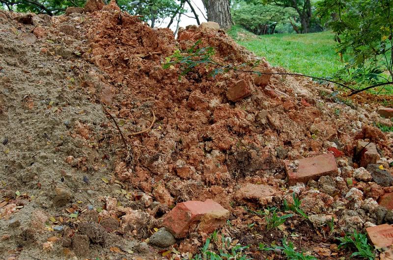
14. Close up of the pile. What can grow on this?
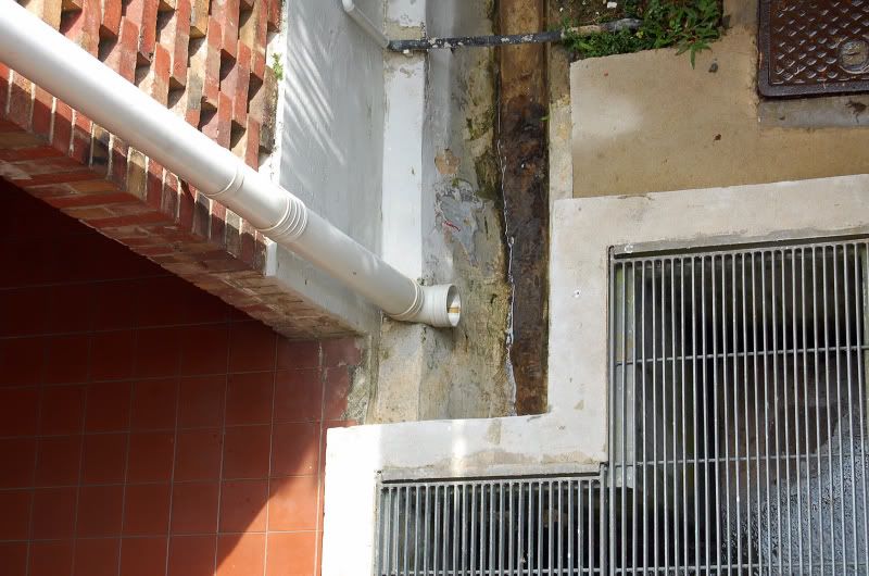
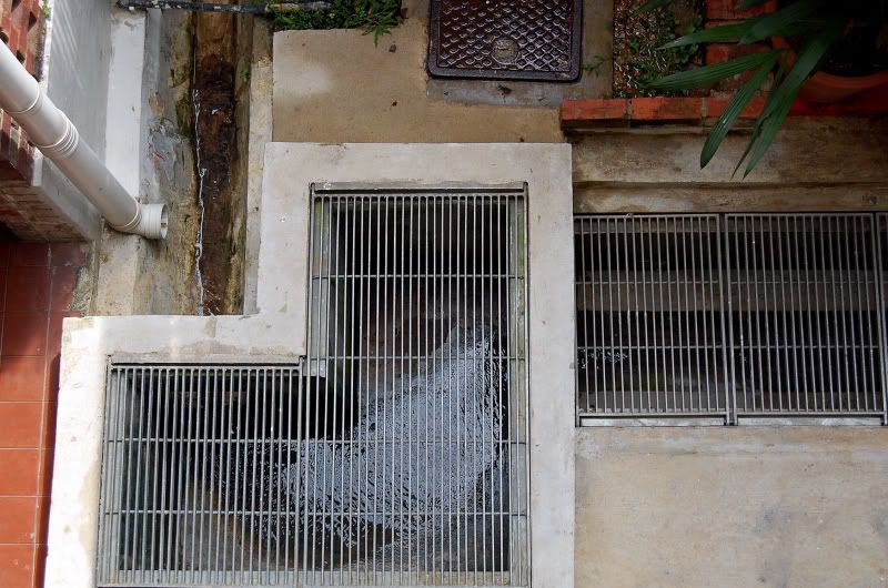
15. Lastly, a picture of a drain pipe outside LT 11 to show how poor construction of drains can cause flooding during heavy rainfall.(According to what the lecturer says) Water splashes out when it tries to go round the perpendicular drain and that causes quite abit of problem.
16.
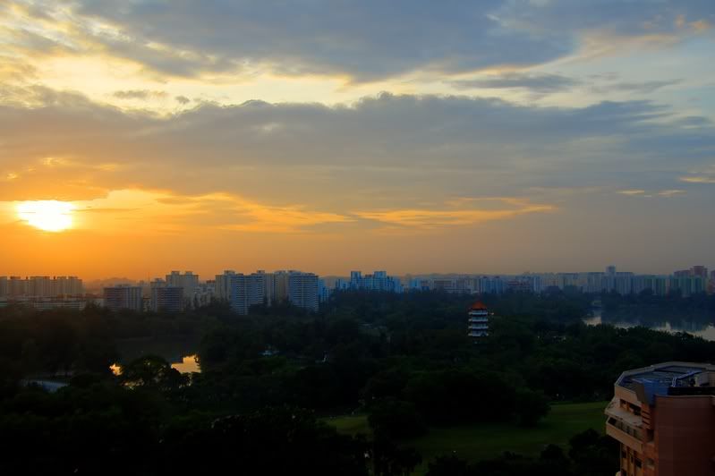
17. And lastly, I end with a sunset taken in HDR.
2. Slope Modification. This is a slope near the School of Design and Environment where it is being urbanised and had man made structures built on top of it. This results in large amount surface runoffs during heavy rain and when the soil is unable to hold the sudden influx of water, landslides can occur. It is said that a landslide occured at this location 3 years ago. Ironic isn't it... at the School of Design & Environment.
3. Just a candid picture of everyone chionging to go take the pipes at the drain. Just like what Neil Humphrey said, we all just rush to some place, snap, and go. Come on, the drain isnt gonna run away.
4. Ok.... to the drains.... These drainage pipes are installed to run beneath the slope so that they can drain excess water away from the soil during heavy rainfall. However, we didnt see any water draining out from these pipes although the drain is running with water after the rain that just stopped.
5. I once remembered someone (Probably another Geography lecturer) telling me what are these structures for. Apparently, they are built to hold excess water in an event of sudden surge of water coming in, so that the drains wont overflow. Too bad I didnt take to show how it is like top down.
6. Just another candid pic. Not sure what the lecturer is explaining though.
7. The third site we visit, showing how we can modify a slope to stabalize it. Again this place is prone to landslide. Improvement to the slope includes drainage holes, concrete slabs to stabalize the ground and a fence built to prevent the rocks from falling down in an event of a landslide.
8. Showing the concrete slabs (half covered with grass) implemented to stabalize and hold the soil on the slope together.
9. The fence to prevent the huge chunk of rock from rolling down to the footpath below.
10. Not sure what are they for, perhards to prevent landslide also.
11. Lastly, this place is just before the round-a-bout at YIH showing urban vegetation and the soil and how it impacts the grass growing on it. The grass here seems to grow on "spots" and its like they are just newly planted. But no on closer observation, its just because the bare spots are quite unsuitable for plant growth.
12. Close up of a bare spot with clay, rocks and sand.
13. Pile of unused soil left here after a recent construction.
14. Close up of the pile. What can grow on this?
15. Lastly, a picture of a drain pipe outside LT 11 to show how poor construction of drains can cause flooding during heavy rainfall.(According to what the lecturer says) Water splashes out when it tries to go round the perpendicular drain and that causes quite abit of problem.
16.
17. And lastly, I end with a sunset taken in HDR.
Labels: landscape
posted by white5tar at 7:20 PM
![]()

6 Comments:
1. #6, the lcturer is a girl?
2. sci fac also had landslide
3. #9, u sure the erm, thin fence can really prevent tt huge rock from rolling or casading down
This comment has been removed by the author.
badly done hdr :(
other pics are nice thou
Hey! We're fellow NUS students doing GE2220 Terrestrial and Coastal Env and we went on site visits in NUS to evaluate the soil conditions too! sounds exactly like what you did for your biophysical! Is it ok if we use your pictures for use in our project? Can credit you in the report, provide details to how you want to be credited? Thanks:D
Dear Pris,
Please feel free to use the photos which you will like for your project.
Glad to be of assistance to your module.
A short credit in the report stating the site which you obtain the photos will be sufficient.
Sincerely,
Yin Kum
Hey, any advice for this mod? Izzit do-able?
Post a Comment
<< Home